
Cuyahoga County Postal Coverage
The County emergency-addressing layer exposes a wide set of five-digit postal areas. The ZIP code table below keeps the County source's primary delivery geography and warning together. It is not a municipal map or a list of present occupants. Edge values can reach Lake, Geauga, or Lorain County, while inner-ring values can span more than one municipality. Verify an individual street with USPS before assigning an office, court, record series, or local government to the address.
| ZIP | Areas covered | Post office or boundary note |
|---|---|---|
| 44017 | Berea / southwest County | Berea delivery; check the municipality street by street. |
| 44022 | Chagrin Falls / southeast edge | Postal geography crosses municipal and county edges. |
| 44023 | Chagrin Falls area | Edge delivery geography; confirm the exact site. |
| 44028 | Columbia Station edge | Adjacent-delivery value represented in County data; confirm the site. |
| 44039 | North Ridgeville edge | Adjacent Lorain-area delivery geography, not county-jurisdiction proof. |
| 44040 | Gates Mills / Chagrin area | Cuyahoga/Geauga edge; verify the street. |
| 44070 | North Olmsted | Southwest and Westshore postal area. |
| 44092 | Wickliffe / Lake County edge | Adjacent delivery geography; verify address and county. |
| 44095 | Eastlake / Lake County edge | Adjacent delivery geography; verify address and county. |
| 44096 | Willoughby / Lake County edge | Adjacent delivery geography; verify address and county. |
| 44101 | Cleveland | Central Cleveland postal value; confirm individual delivery. |
| 44102 | Cleveland west side / Lakewood edge | Crosses neighborhoods, not city-ward lines. |
| 44103 | Cleveland east and central | Cleveland delivery area. |
| 44104 | Cleveland | Cleveland delivery area. |
| 44105 | Cleveland southeast | Cleveland delivery area. |
| 44106 | Cleveland / University Circle / Cleveland Heights edge | Municipal mismatch is common; check the exact address. |
| 44107 | Lakewood | Lakewood delivery geography. |
| 44108 | Cleveland east | Cleveland delivery area. |
| 44109 | Cleveland south and west | Cleveland delivery area. |
| 44110 | Cleveland northeast | Cleveland delivery area. |
| 44111 | Cleveland west | Cleveland delivery area. |
| 44112 | Cleveland / East Cleveland edge | Postal geography may cross the municipal line. |
| 44113 | Cleveland downtown and near west | Cleveland delivery area. |
| 44114 | Cleveland downtown | Cleveland delivery area. |
| 44115 | Cleveland downtown | Cleveland delivery area. |
| 44116 | Rocky River | Westshore delivery area. |
| 44117 | Cleveland | Cleveland delivery area. |
| 44118 | Cleveland Heights / University Heights | Postal city and municipal limits require a street check. |
| 44119 | Cleveland northeast | Cleveland delivery area. |
| 44120 | Cleveland / Shaker Heights edge | One value spans municipalities. |
| 44121 | South Euclid / Cleveland Heights area | Inner-ring delivery geography. |
| 44122 | Beachwood / east-side area | City limit and postal boundary differ. |
| 44123 | Euclid | Lakefront and east delivery geography. |
| 44124 | Lyndhurst / Mayfield area | Hillcrest delivery geography. |
| 44125 | Cleveland / Garfield Heights / Cuyahoga Heights area | Municipal mismatch is common. |
| 44126 | Fairview Park | Westshore delivery geography. |
| 44127 | Cleveland | Cleveland delivery area. |
| 44128 | Cleveland east | Cleveland delivery area. |
| 44129 | Parma | Parma delivery geography. |
| 44130 | Brook Park / Middleburg Heights area | Southwest delivery geography. |
| 44131 | Independence / Seven Hills / Brooklyn Heights area | Multiple-municipality delivery geography. |
| 44132 | Euclid | East County delivery geography. |
| 44133 | North Royalton | Southcentral delivery geography. |
| 44134 | Parma / Parma Heights area | Southwest delivery geography. |
| 44135 | Cleveland | Cleveland delivery area. |
| 44136 | Strongsville | Southwest delivery geography. |
| 44137 | Maple Heights / Bedford area | Municipal boundary check needed. |
| 44138 | Olmsted Falls / Olmsted Township area | Southwest-edge delivery geography. |
| 44139 | Solon | Southeast delivery geography. |
| 44140 | Bay Village / Westlake area | Westshore delivery geography. |
| 44141 | Brecksville | South County delivery geography. |
| 44142 | Brook Park | Southwest delivery geography. |
| 44143 | Richmond Heights / Highland Heights area | Hillcrest delivery geography. |
| 44144 | Brooklyn | Inner-ring and southwest delivery geography. |
| 44145 | Westlake | Westshore delivery geography. |
| 44146 | Bedford / Bedford Heights area | Southeast and inner-ring delivery geography. |
| 44147 | Broadview Heights | South County delivery geography. |
| 44149 | Strongsville | Southwest delivery geography. |
Note: A County-addressing value can identify a delivery area, but the relevant city, village, township, or county office still depends on the specific street address.
Cleveland Core ZIP Areas
Most values from 44101 through 44115, plus 44117, 44119, 44127, 44128, and 44135, are described as Cleveland delivery geography. That is a useful first sort for a Cuyahoga County postal search, but it should not erase close boundaries. The source flags 44102 near Lakewood, 44106 at the University Circle and Cleveland Heights edge, 44112 at the East Cleveland edge, 44120 at the Shaker Heights edge, and 44125 across Cleveland, Garfield Heights, and Cuyahoga Heights. A postal label is therefore a starting point for municipal routing, not the final jurisdiction.
For a Cleveland-specific request after the municipality is confirmed, use the city's own public record route. For a county-held parcel, deed, or map question, retain the exact address and carry it to the County system.
Cuyahoga Postal Edge Areas
The County's outer delivery geography shows why an edge check matters. Values 44023, 44028, 44039, 44040, 44092, 44095, and 44096 are all marked as edge or adjacent-delivery areas. Chagrin Falls can reach across municipal and county edges. North Ridgeville points toward Lorain-area delivery geography, while Wickliffe, Eastlake, and Willoughby point toward Lake County. None of those labels settles the county or municipal custodian for a particular street.
Use a postal result to identify the delivery geography, then retain the street address, municipality, and date of the check. That small record makes it possible to explain why a later county parcel or municipal record uses a different place label.
Cuyahoga Residents by ZIP
Finding a person within one postal area is a narrowing workflow, not a public bulk roster. USPS can validate an address, city and state, or five-digit value. The County ZIP-area GIS service can visualize the postal area. Then use the confirmed street and municipality in the record system that is actually built for an individual place. MyPlace is the County's parcel lead, and the Official Records Search is the recorded-document lead. The inspected sources did not document a ZIP-wide people or property result screen.
- Use USPS ZIP Code Lookup to confirm the address-to-ZIP, city/state-to-ZIP, or ZIP-to-city result.
- Review the County ZIP-area GIS service for the delivery-area context.
- Confirm the municipality for the exact street, especially at an inner-ring or outer-county edge.
- Search the full address, parcel, or owner lead in Cuyahoga County MyPlace, then preserve the parcel number and site label.
- Use the recorded-document index or the proper municipal custodian when the question concerns a dated instrument or local file.
Once an area is narrowed to a street, the Cuyahoga County street directory provides the address-by-address record sequence. Postal geography should remain the first filter, not a substitute for that record trail.
Cuyahoga ZIP Search Limits
No reviewed MyPlace, Recorder, or Ohio voter interface documented a ZIP code filter. MyPlace offers City, Owner, Parcel, and Address modes. Ohio's voter lookup uses a person's first name, last name, and County, and the Recorder uses address, parcel, party, date, and document controls. The gap matters because a countywide postal-area result should not be invented from tools that do not advertise it. Use the GIS layer to see an area, USPS to validate it, and an address or parcel to inspect a specific place.
| USPS address mode | Verify a street address against its delivery ZIP. |
|---|---|
| USPS city/state mode | Check the values associated with a named postal city and state. |
| USPS ZIP-to-city mode | Return the postal city associated with a five-digit value. |
| MyPlace modes | City, Owner, Parcel, and Address, with no reviewed postal-area filter. |
| Recorder modes | Address, parcel, party, date, document, volume, and page controls rather than a postal-area search. |
The Cuyahoga Official Records Search is the appropriate follow-on for a recorded document once an address, parcel, party, or date is known.
Cuyahoga Regional ZIP Geography
Cuyahoga County Planning Commission groups communities into eight regions, including Cleveland, Heights, Hillcrest, Westshore, Southwest, Southcentral, Cuyahoga, and Chagrin/Southeast. Those regional names give practical context to postal areas without claiming that a planning region is a postal boundary. Westshore includes Bay Village, Fairview Park, Lakewood, North Olmsted, Rocky River, and Westlake. Heights includes Cleveland Heights, East Cleveland, Shaker Heights, and University Heights. Hillcrest includes Beachwood, Euclid, Gates Mills, Lyndhurst, and other east-side communities.
The Cuyahoga County Board of Elections map and data route is a separate civic geography source, rather than a postal-area map.
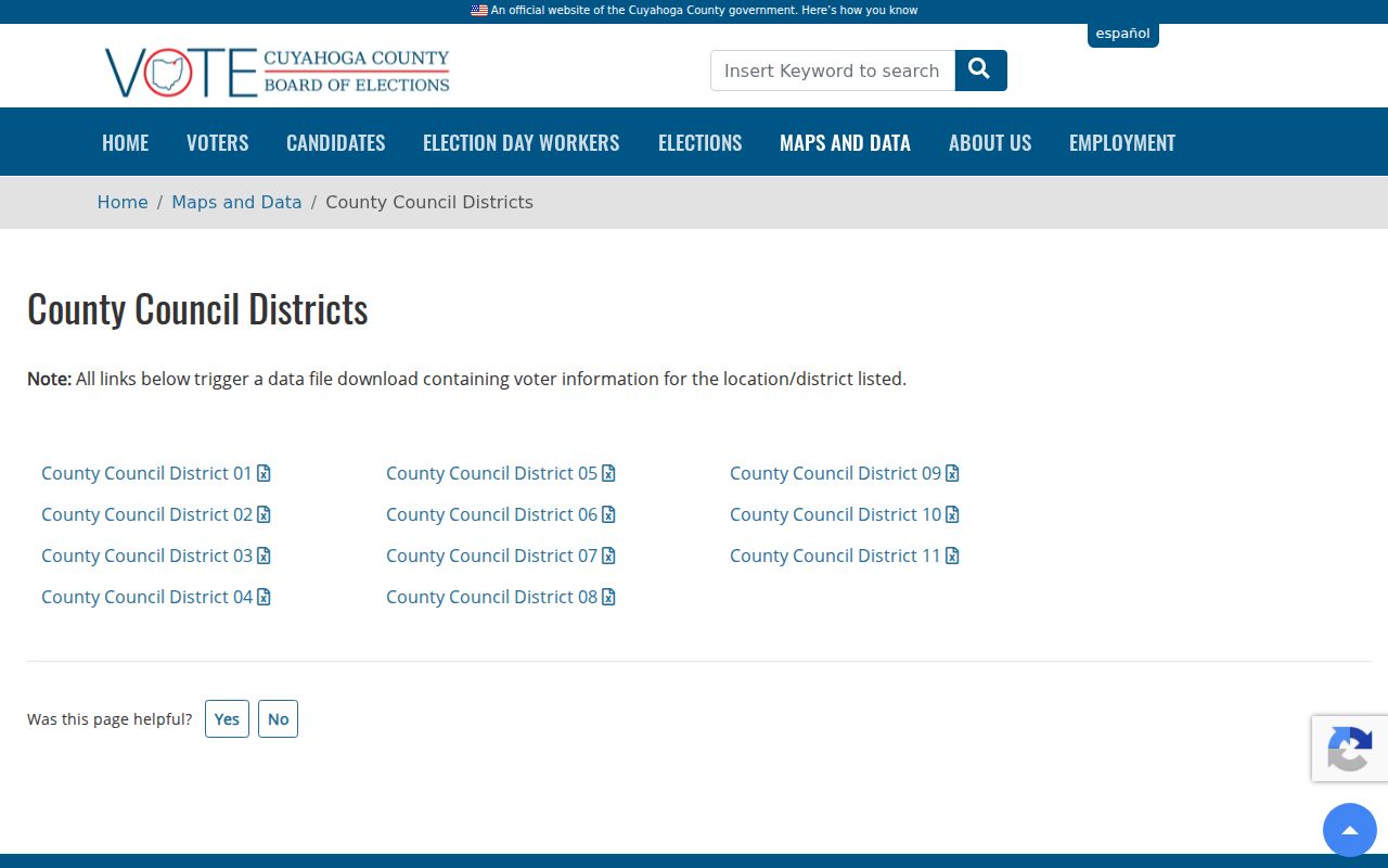
Comparing the civic map with the confirmed municipality helps prevent a postal area from being mistaken for a voting or local-government boundary.
Cuyahoga Planning Data Context
County Planning's current data work adds geographic context to a postal search. Its 2025 Our Communities Data Book provides 62 indicators for every city, village, and township, and the 2026 county-level edition provides 63 indicators. These are community-data resources, not name or address databases. They are useful when a question involves which community an address belongs to, how a municipal area is described, or which map service may have the needed local context.
The Cuyahoga County planning regions page shows the County's regional framework.
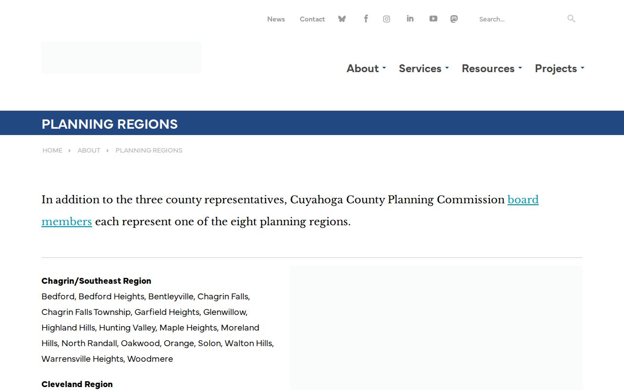
Planning regions add a second geography check when a postal label and the municipality do not line up neatly.
Cuyahoga Postal Boundaries
A ZIP code is USPS delivery geography, not a municipal boundary, parcel, voting district, or proof that a person or company is at an address. The local mismatch examples are clear: 44106 reaches the Cleveland Heights edge, 44118 covers Cleveland Heights and University Heights, 44120 reaches Shaker Heights, and 44131 serves several municipalities. Check the street with USPS, identify the municipality, and then use the County parcel or municipal record keeper for the question at hand.
- ZIP vs ZIP+4
- The five-digit delivery area differs from the added four-digit sorting detail attached to a more specific address.
- PO-box ZIP
- A postal value used for post-office boxes; it does not establish the physical location of a parcel.
- Unique ZIP
- A value used for a single organization or large destination, distinct from an ordinary residential delivery area.
- Carrier route
- A mail-delivery sequence inside a postal area, not a city boundary or a resident list.
Note: USPS states that a delivery result does not confirm that a particular person or company is at the address checked.
Cuyahoga Parcel Address Labels
After the postal and municipal checks, use the address labels that Cuyahoga County records actually maintain. A situs address identifies the physical parcel. A mailing address identifies where tax correspondence goes. A legal description identifies the recorded lot or boundary, and the Permanent Parcel Number connects the MyPlace card to map material. These labels answer different questions, so a ZIP code result should not be substituted for any of them.
The County Site Addresses layer distinguishes address, unit, municipality, subdivision, ZIP, status, and postal relationship. When older records conflict with a newer address, keep the source spelling and compare the legal description, map book or page, and parcel history. County Archives cautions that street names, property dimensions, and descriptions can change, so an apparent mismatch requires a record check rather than a guess.
The U.S. Census QuickFacts profile for Cuyahoga County supplies countywide context, not address confirmation.
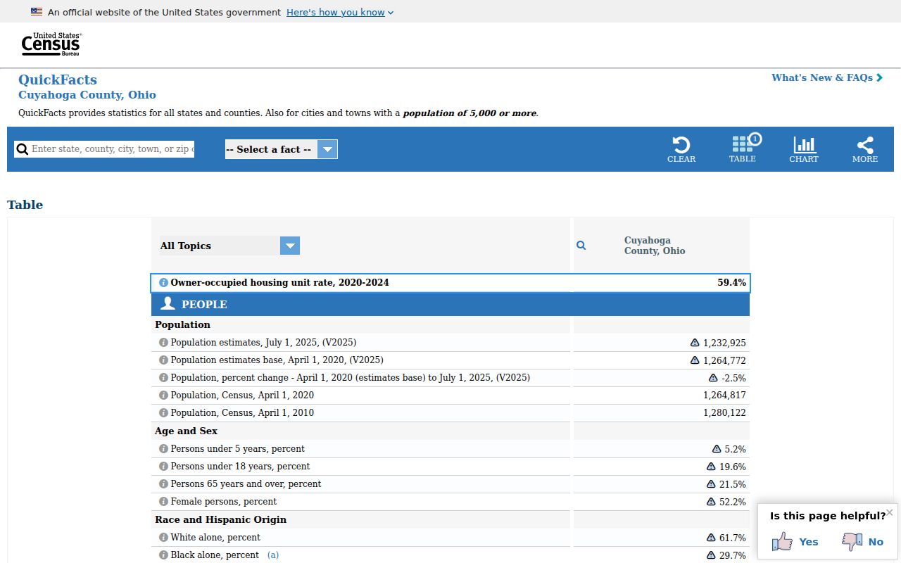
The countywide profile helps frame the scale of the County without changing the source-specific address and parcel checks required for a record.